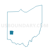
PRECINCT FARMERSVILLE, Montgomery County, Ohio
About
Outline

Summary
| Unique Area Identifier | 650166 |
| Name | PRECINCT FARMERSVILLE |
| County | Montgomery County |
| State | Ohio |
| Area (square miles) | 0.71 |
| Land Area (square miles) | 0.71 |
| Water Area (square miles) | 0.00 |
| % of Land Area | 100.00 |
| % of Water Area | 0.00 |
| Latitude of the Internal Point | 39.67870300 |
| Longtitude of the Internal Point | -84.42743120 |
Maps


Graphs
Select a template below for downloading or customizing gragh for PRECINCT FARMERSVILLE, Montgomery County, Ohio